The use of LiDAR technology offers rapid and high resolution capture of surface elevation data, suitable for a variety of products that easily integrates with GIS and CAD systems. We have extensive experience in working with LiDAR data. We are offering wide range of
Aerial, Terrestrial and Mobile LiDAR products which include: LiDAR based vector and raster products, LiDAR point cloud classification, DTM development, LiDAR system calibration.
OFFER
- LiDAR based vector products
– feature collection, contours - LiDAR based raster products
– terrain models, shaded relief - LiDAR System Calibration
- Point Cloud Processing – ground, vegetation, buildings, hydrology
- Terrestrial and Mobile LiDAR development
STANDARDS
- ASPRS Accuracy Standards for Digital Geospatial Data
- ASPRS Lidar Guidelines
- USGS Lidar Base Specification
- LAS Format Specification
OUTPUT
DATA FORMATS
LiDAR point cloud:
- LAS, LAZ, Fast binary, XYZ (txt), EarthData (EBN, EEBN)
LiDAR-based vector products:
- DGN, DWG, DXF, ESRI
- Shapefile
LiDAR-based raster products:
- GeoTIFF, ASCII Grid
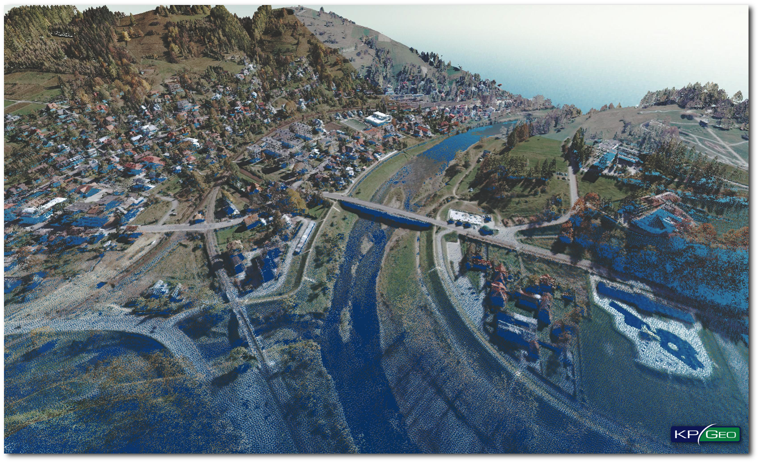
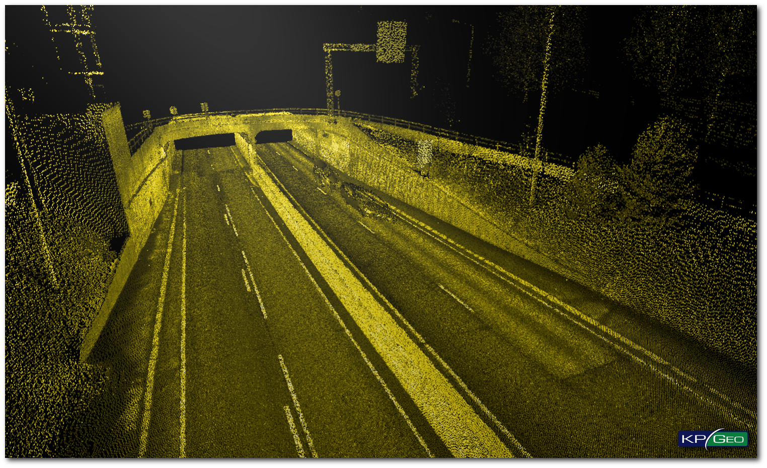
EXAMPLES OF LIDAR DATA
Classified LiDAR Point Cloud with RGB information
Mobile LiDAR – Change detection analysis of tunels
CONTACT
KPGeo Sp. z o.o.
ul. Królewska 65
30-081 Kraków, Poland
T: +48 12 379 3170

KPGeo LLC
P.O. Box 7173
Overland Park, KS 66207
USA
Tel. +1 631-882-2296