Our Terrain and Obstacle data meet ICAO Area 2 requirements for eTOD. Our products are developed to meet all international aviation requirements and support Performance – Based Navigation (PBN), which is a turnkey solution to decrease costs for aviation organizations by presenting possibilities to reduce fuel waste, carbon emission and increase flight frequency.
eTOD – geospatial data related to obstacles and terrain, which meet the ICAO requirements specified in Annex 15 of the Convention on International Civil Aviation.
eTOD is part of the modern Aeronautical Information Management (AIM) system – which is replacing traditional Aeronautical Information System (AIS). This change is being mandated by the operational concept known as Future Air Navigation Systems (FANS) from ICAO, which is being operationally implemented in the EU as Single European Sky (SESAR) and in the US as Next Generation Air Transportation System (NEXTGEN)
OFFER
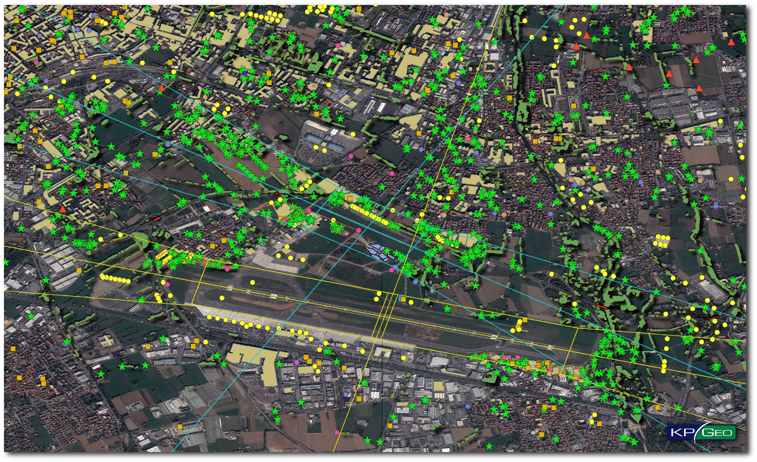
eTOD – Obstacle Data – – 3D databases represents obstacle data collected and recorded in accordance with the Area 2 numerical requirements. In the data collection process are used Area 2 Obstacle Limitation Surfaces.
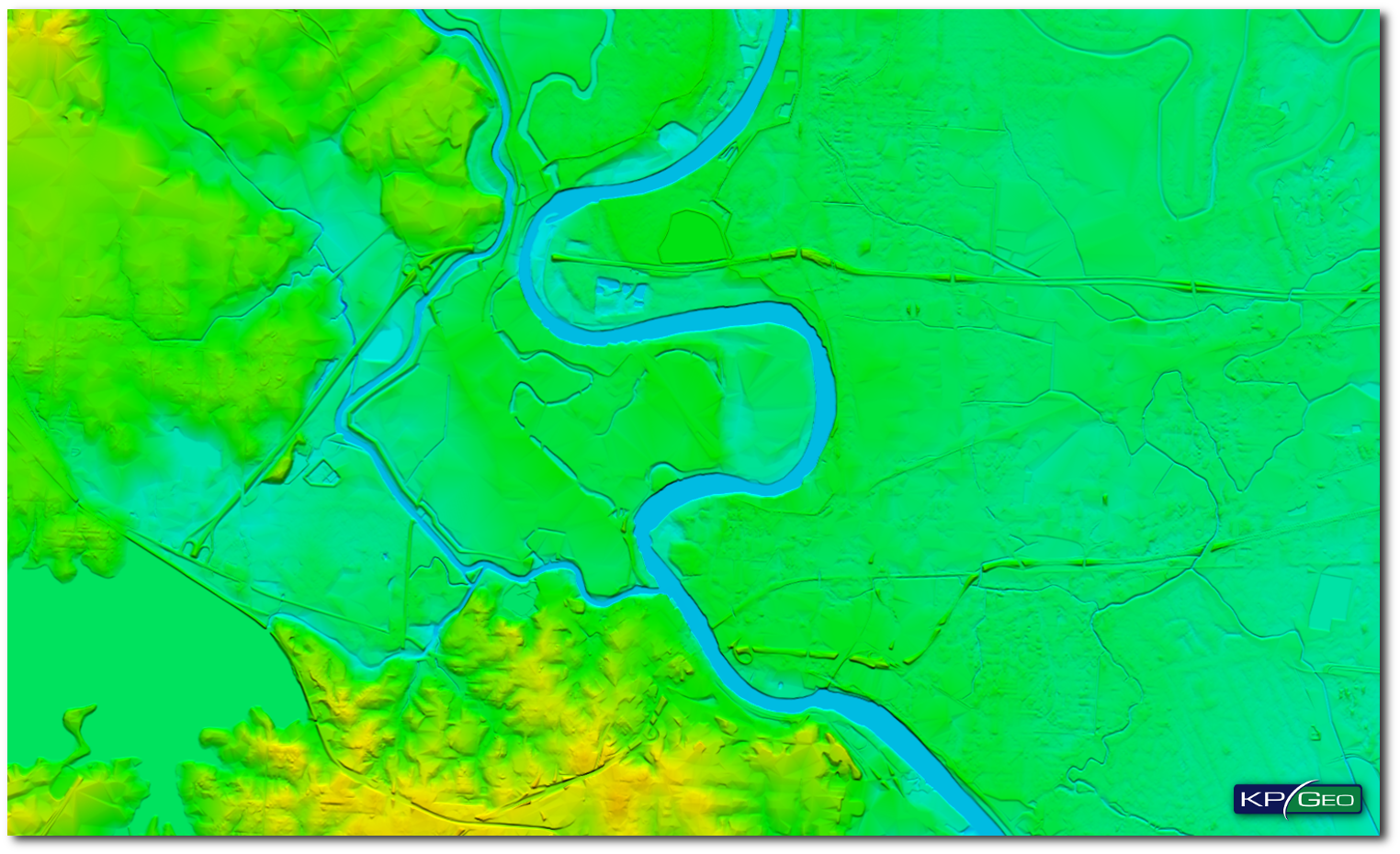
eTOD- Terrain Data which contain digital sets of data representing terrain surface in the form of continuous elevation values.
STANDARDS
- RTCA DO-276/EUROCAE ED-98
- RTCA DO-291/EUROCAE ED-119
- ICAO requirements contained in Annex 15
- AIXM (Aeronautical Information Exchange Model) requirements
OUTPUT
DATA FORMATS
Vector data formats:
- ESRI Geodatabase
- ESRI Shapefile
- AIXM
Terrain data formats:
- GeoTiff
- DTED
- USGS
EXAMPLES OF KPGEO ETODS
eTOD Obstacles Database (Orio al Serio International Airport ICAO:LIME)
eTOD Terrain (Shreveport Downtown Airport ICAO: KDTN)
CONTACT
KPGeo Sp. z o.o.
ul. Królewska 65
30-081 Kraków, Poland
T: +48 12 379 3170

KPGeo LLC
P.O. Box 7173
Overland Park, KS 66207
USA
Tel. +1 631-882-2296