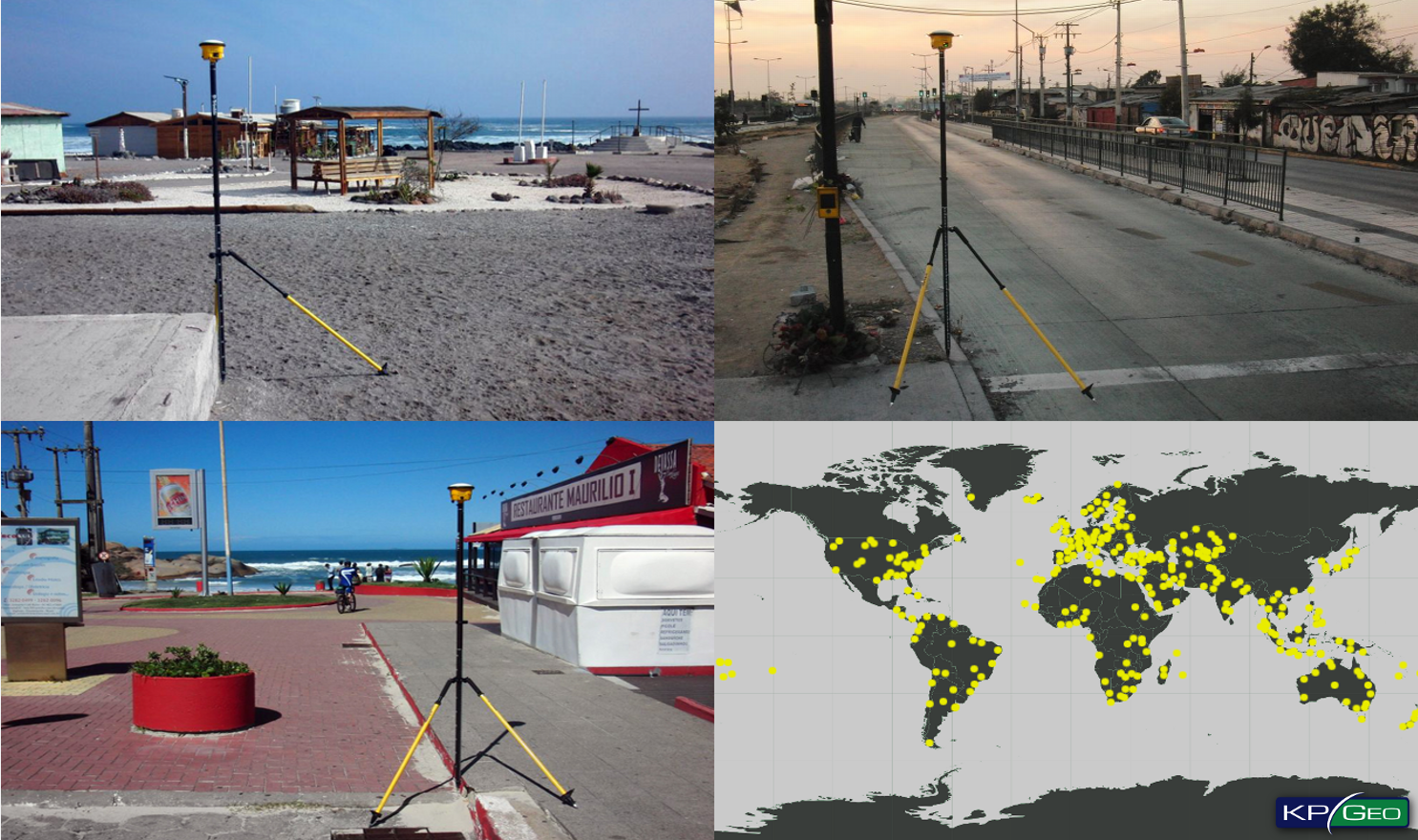
The KPGeo team has extensive experience with small and large ground control point (GCPs) surveys around the globe including Africa, Asia, Australia, Europe and South America. : Through the collaboration with our global network of partners and using our resources, we have performed GCP surveys at more than five hundred project locations. Our GCP offer includes: Ground Control Points planning and measurements, in-situ photo documentation, measurement reports preparation, coordinate transformations.
OFFER
- Ground Control Points measurements all over the world
- Survey report – detailed report containing the information about the accuracy and survey methods used
- Field sketches and photo documentation
- Coordinate conversion in a wide range of refence horizontal and vertical systems
TECHNOLOGY
- Our Trimble GNSS Receivers supports multiple satellite constellations and correction sources for accurate data at any location
- We are using Trimble Maxwell 6 chip with 220 channels and leading GNSS technology maximizes data quality
- We have experience using different measurement methods including: OmniSTAR, Static survey, Real-time Kinematic
KPGEO GCP ARCHIVES
Welcome to the KPGeo Geoportal, designed to showcase the locations where KPGeo have measured Ground Control Points (GCP). Each GCP entry includes rounded coordinates, measurement accuracy, and the date of capture, along with links to comprehensive documentation, including photos and sketches. For exact coordinates and original data, simply place an order at sales@kpgeo.pl.
To start using the Geoportal, simply draw an outline around your area of interest.
User Instructions
- Zoom In/Out: Use the zoom controls to adjust the map view.
- Reset Map View: Return to the initial map view.
- Draw Tool: Outline points to list them in the table/export.
- Table Tool: Display all outlined points.
- Clear Outline: Remove the drawn outline.
- Switch Basemap: Toggle between basemaps.
- Coordinate Tool: Click to show coordinates, which can be copied.
Table Functions
- Export points to CSV: Use to export outlined points to CSV format.
- Export points to KML: Use to export outlined points to KML format.
- Access links to point photos and sketches (linked to KPGeo Sharepoint).
EXAMPLES OF GCP LOCALIZATIONS
CONTACT
KPGeo Sp. z o.o.
ul. Królewska 65
30-081 Kraków, Poland
T: +48 12 379 3170
KPGeo LLC
P.O. Box 7173
Overland Park, KS 66207
USA
Tel. +1 631-882-2296