Ortho products offered by KPGEO can be used for many purposes in a GIS environment e.g. for planning urban and regional infrastructure, creating land-use maps, creating soil maps, determining flood plain boundaries and other important projects. KPGEO offers Orthophoto and True-Orthophoto derived from Aerial, UAV, or satellite imagery. GIS ready!
OFFER
- Orthophoto maps
- True orthophoto maps
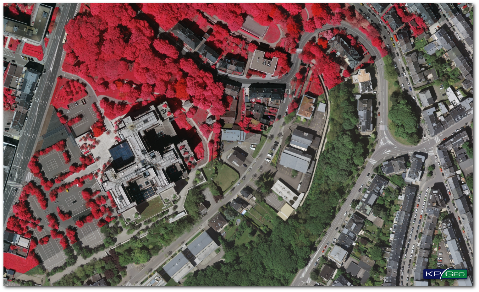
- Infrared orthophoto maps (CIR)
OUR TECHNOLOGY
We can create orthophoto maps based on Aerial, UAV or Satellite imagery. KPGeo is able to perform all stages of orthophoto production, like:
- Image acquisition
- Ground Control Points measurement
- Aerotriangulation
- Orthorectification
- Mosaicing with radiometric corrections
- Quality control
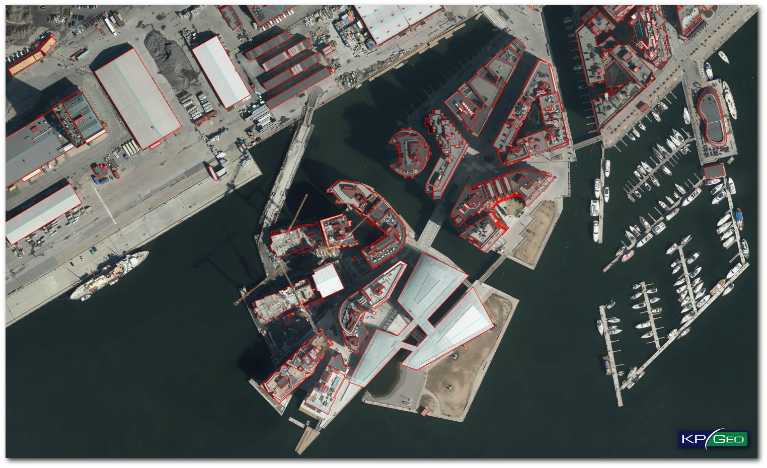
In our offer we have also heavily specialized product: True-Orthophotomaps with complete orthogonality of the image.
OUTPUT DATA CHARACTERISTIC
Bands:
- RGB, RGBI, CIR
Resolution:
- From 2 cm
Formats:
- GeoTIFF, ECW, ERDAS Image
EXAMPLES OF ORTHOPHOTO PRODUCTS
RGB/CIR Orthophoto
True-Orthophoto
CONTACT
KPGeo Sp. z o.o.
ul. Królewska 65
30-081 Kraków, Poland
T: +48 12 379 3170
KPGeo LLC
P.O. Box 7173
Overland Park, KS 66207
USA
Tel. +1 631-882-2296