Our AMDBs are produced using stringent aeronautical standards and supports on-board applications, which improve safe surface navigation, increase safety margins and operational efficiency.
AMDB - airport mapping data organized in aerodrome mapping databases (AMDBs), which meet the ICAO requirements specified in Annex 15 of the Convention on International Civil Aviation.
AMDB is part of the modern Areonautical Information Management (AIM) system – which is replacing traditional Aeronautical Information System (AIS). This change is being mandated by the operational concept known as Future Air Navigation Systems (FANS) from ICAO, which is being operationally implemented in the EU as Single European Sky (SESAR) and in the US as Next Generation Air Transportation System (NEXTGEN)
OFFER
AMDB (Aerodrome Mapping Database) – 3D database of airports, containing all ground infrastructure elements and vertical elements, taller than 0.5m, located inside the 50/90 m buffer zone.
STANDARDS
- RTCA DO-272/EUROCAE ED-99
- RTCA DO-291/EUROCAE ED-119
- ICAO requirements contained in Annex 15
- AIXM (Aeronautical Information Exchange Model) requirements
OUTPUT
DATA FORMATS
Vector data formats:
- ESRI Geodatabase
- ESRI Shapefile
- AIXM
Terrain data formats:
- GeoTiff
- DTED
- USGS
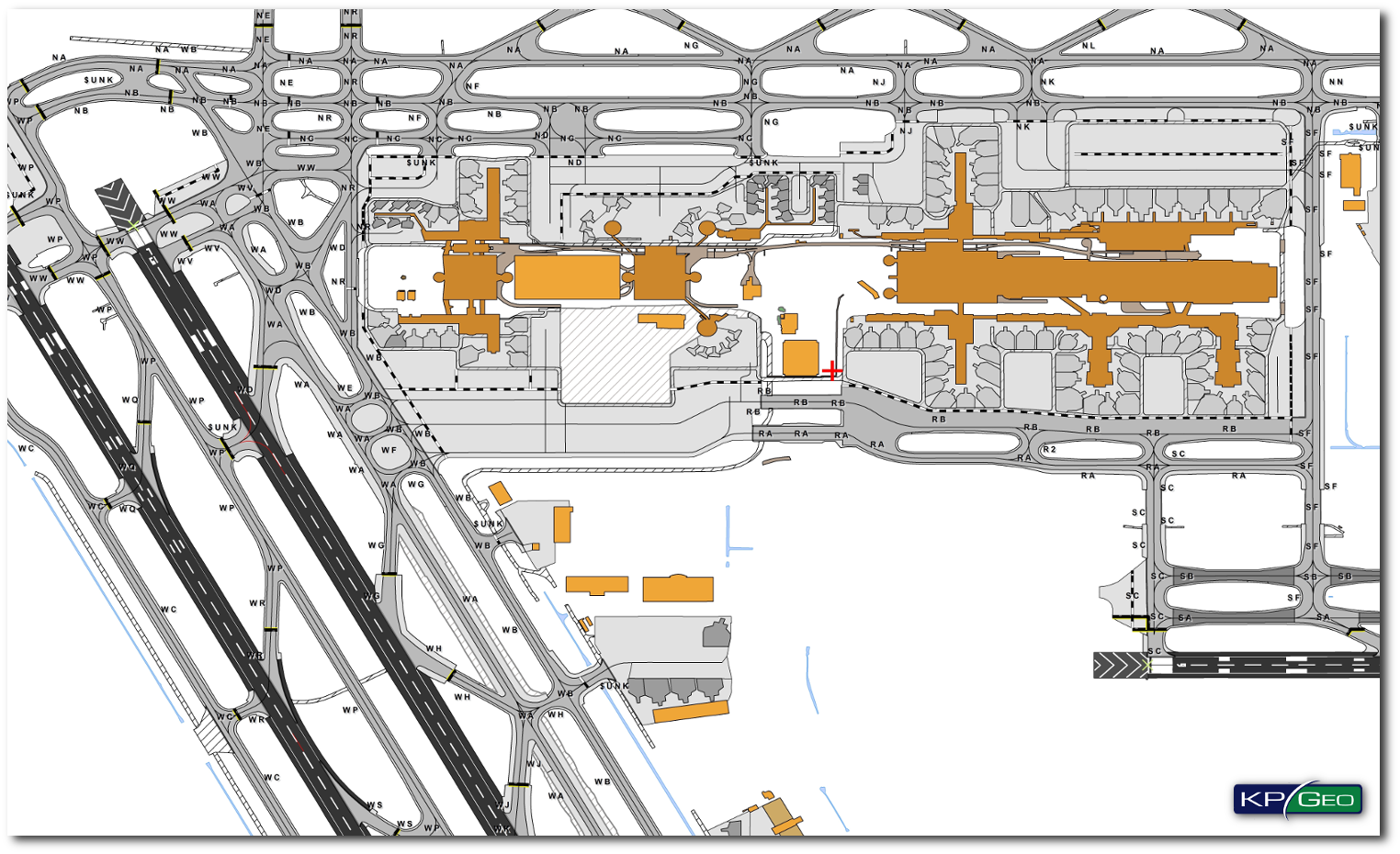
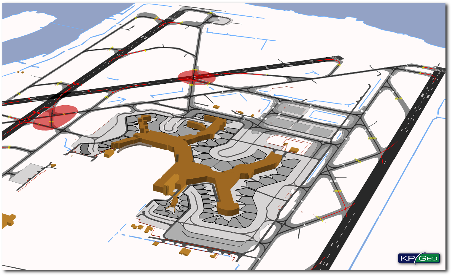
EXAMPLES OF KPGEO AMDBS
AMDB Geodatabase(Houston International Airport ICAO:KIAH)
AMDB Geodatabase (Vancouver International Airport ICAO:CYVR)
CONTACT
KPGeo Sp. z o.o.
ul. Królewska 65
30-081 Kraków, Poland
T: +48 12 379 3170

KPGeo LLC
P.O. Box 7173
Overland Park, KS 66207
USA
Tel. +1 631-882-2296