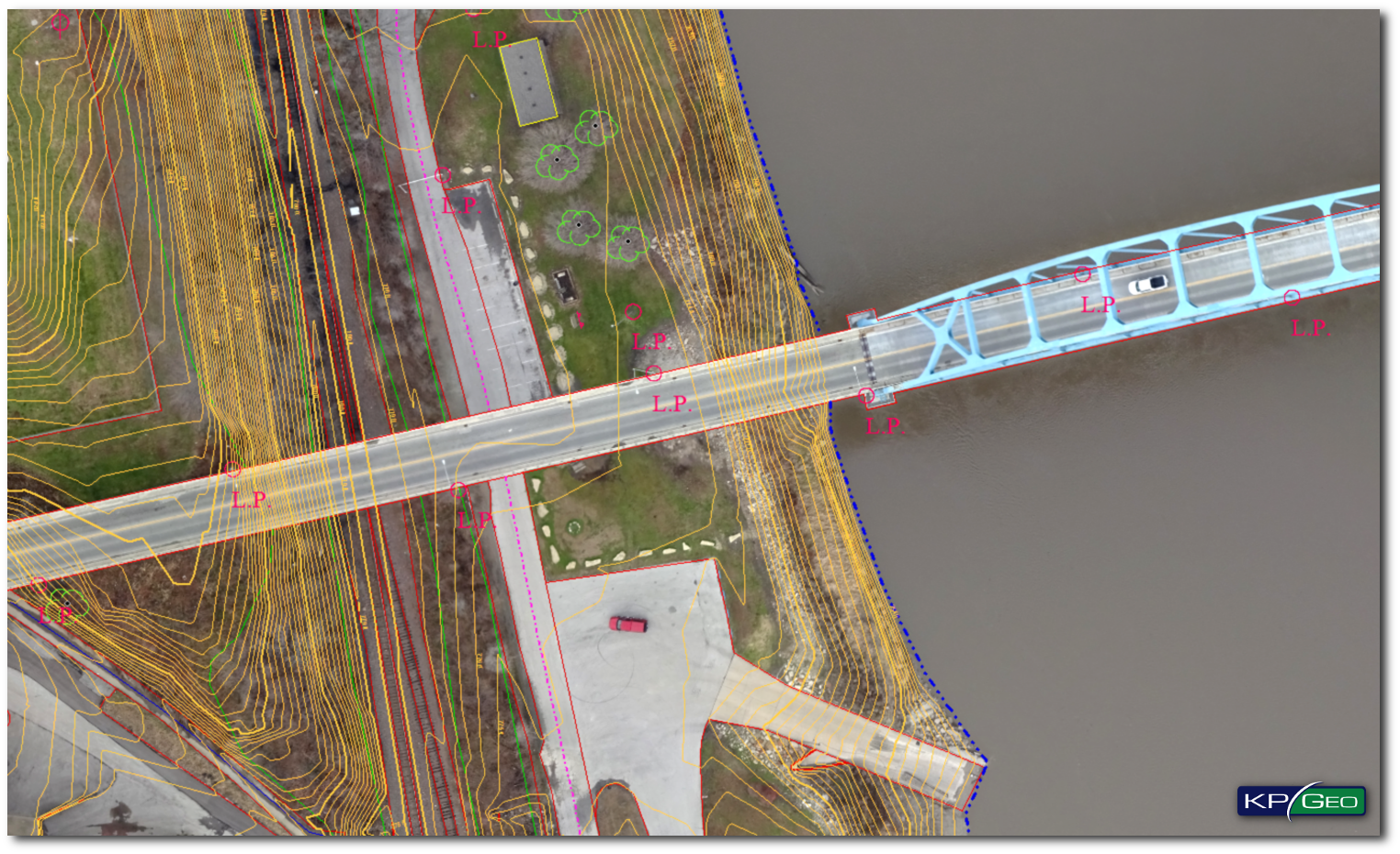
High quality data and data organization are essential for working efficiently and making sound decisions. KPGEO offers: Geospatial data acquisition for GIS and CAD systems. We have experience extracting geospatial data in 2D and 3D using as a base satellite, aerial or UAV imagery.
OFFER
- 3D Vector Data derived from satellite/aerial/UAV
- Geospatial Data for GIS and CAD systems
- Digital Terrain Models and Digital Surface Models
- Land Cover and Land Use maps (LULC)
- Databases for aviation purpose (AMDB, eTOD)
- Databases for military purpose (MGCP)
TECHNOLOGY
- Multi group working using ESRI ArcSDE technology
- 3D extraction with synchronization with GIS software
- Heavily specialized GIS software for 3D analysis, automatic data extraction and classification
- Knowledge, and experience of working even with very complex GIS databases
- Certified workflows and services to deliver the product according to the client’s expectation
EXAMPLES OF GEOSPATIAL PRODUCTS
Update of 3D GIS Database

UAV based 3D CAD Model
CONTACT
KPGeo Sp. z o.o.
ul. Królewska 65
30-081 Kraków, Poland
T: +48 12 379 3170

KPGeo LLC
P.O. Box 7173
Overland Park, KS 66207
USA
Tel. +1 631-882-2296